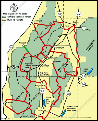
The side trail connects with the main Paiute ATV trail 9 miles southeast of Konosh. Approximate Section Time
·Konosh southeast to main Paiute Trail ---- 0.5 hr
The town of Konosh is located at 4,620 feet elevation. After leaving the town, the ATV side trail gently rises as it heads southeast into Konosh Canyon. It follows Corn Creek, eventually turning south to follow Second Creek. The side trail joins the main Paiute ATV trail only nine miles after beginning the journey. The maximum elevation of this side trail is 6,500 feet.
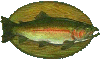
Heading southeastward out of Konosh, trail 06 passes through open areas of sagebrush, rabbit brush, and Utah Juniper. The trail follows Forest Road 106 which is a fairly well traveled dirt road, so keep your speed down, your lights on, and be cautious of other traffic. After two and a half miles the terrain narrows as the trail enters Konosh Canyon at the Forest boundary. The trail gently winds through the canyon along Corn Creek which offers some of the best German Brown trout and Rainbow trout fishing in the State.
Approximately two and a half miles into the canyon is Adelaide Campground. The campground is located adjacent to Corn Creek in a beautiful cottonwood and big tooth maple setting. The campground has six single family sites and one group site. It is perfect a place to camp with quick access to the Paiute ATV Trail.
The trail continues a quarter mile southeast of Adelaide Campground where it meets the convulence of Corn Creek and Second Creek. At the convulence, the trail turns south and follows Second Creek for three miles to where it joins the main Paiute ATV trail, trail 01.
continued next page